Click each of the thumbnail maps below to see a larger view ...
Note: These files will take some time to download .. see caption under each thumbnail.
( Use the browser BACK button to return to this page. )
Note: These files will take some time to download .. see caption under each thumbnail.
( Use the browser BACK button to return to this page. )
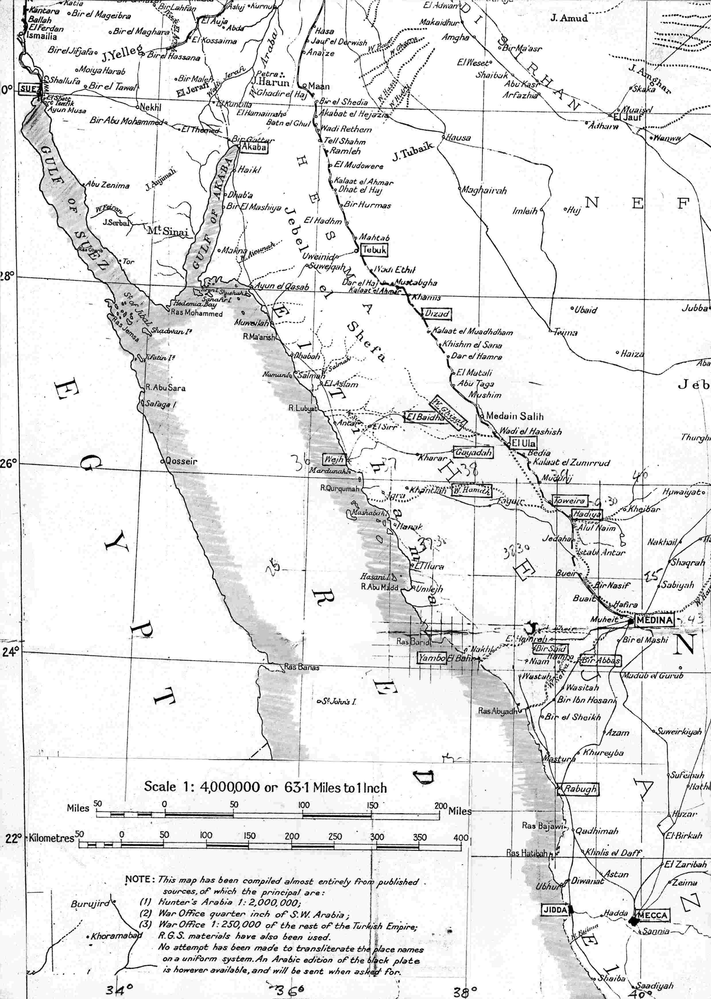
682kb - 1:30 at 56k General map of the Red Sea and the Hejaz, showing the southern part of the railway line which ran from Damascus to Medina. Place names mentioned in the text are boxed for identification. |
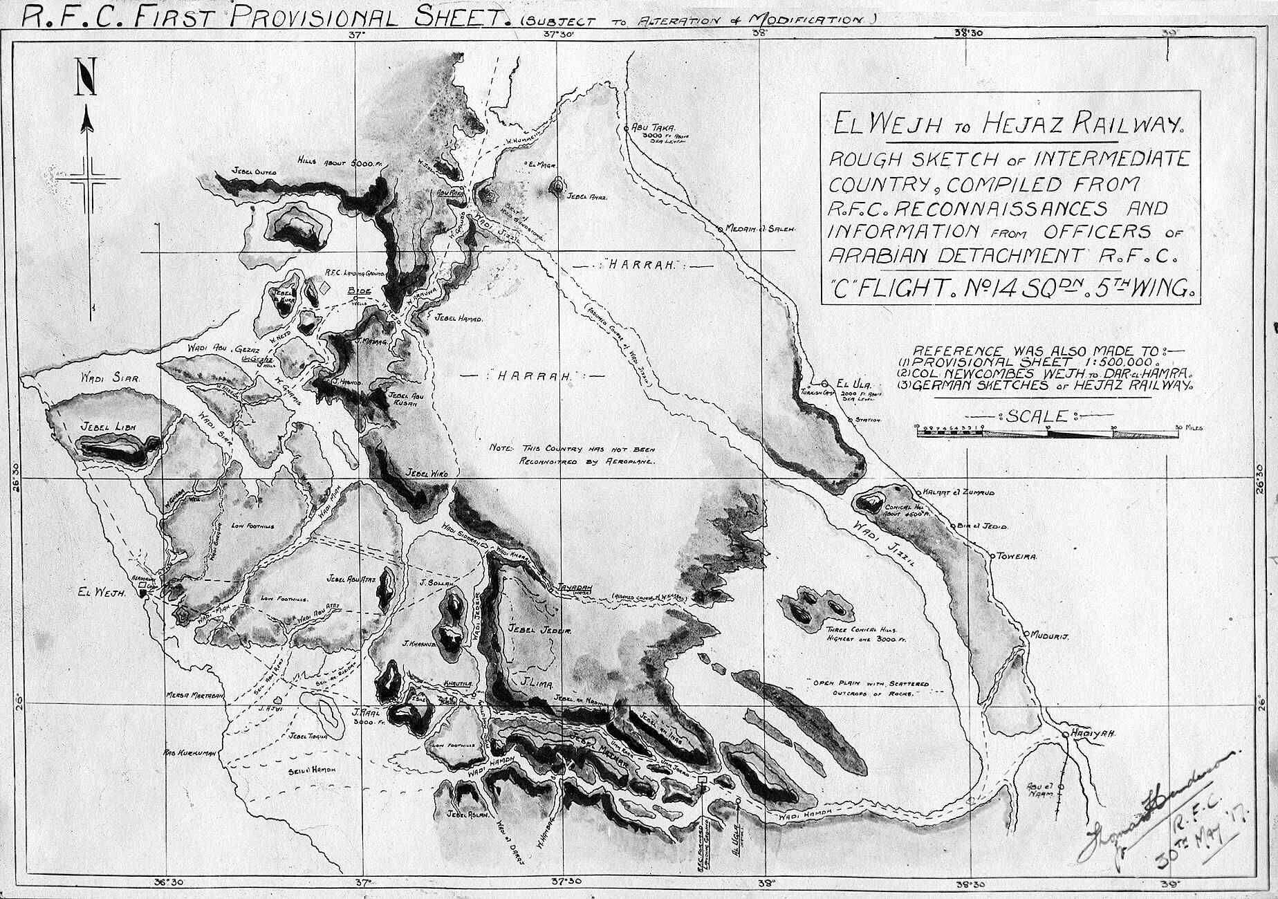
549kb - 1:17 at 56k Capt Henderson's first map of the country between El Wejh and the railway, May 1917. |
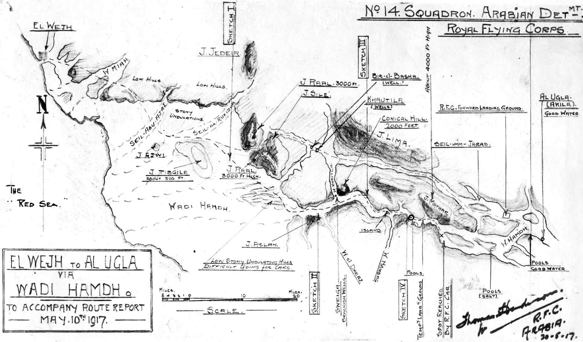
251kb - 0:36 at 56k Capt Henderson's hand-drawn map of the Wadi Hamdh area, produced after his ground reconnaissance route report of 10 May 1917. The Hejaz Railway line lay to the right of this map. |
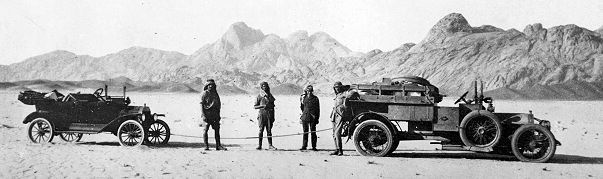
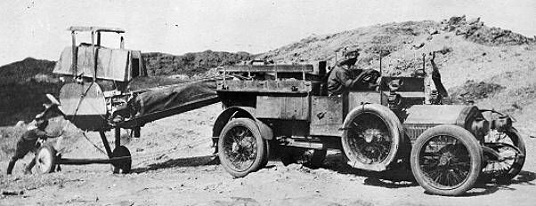
 Above: A typical ground reconnaissance party using a Crossley tender and a Ford Light Car, the latter not really up to this type of job - hence the towrope. 2Lt W.G. Stafford is on the right with Capt T.E. Lawrence next to him.